


Esri and Mobileye to Bring Real-Time Sensor Data to Public Transit
Esri, a leader in spatial analytics, is collaborating with Mobileye, an Intel Company and a leading provider of advanced driver-assistance systems software, to integrate Esri mapping, analysis, and visualization with Mobileye’s Shield+™ product.
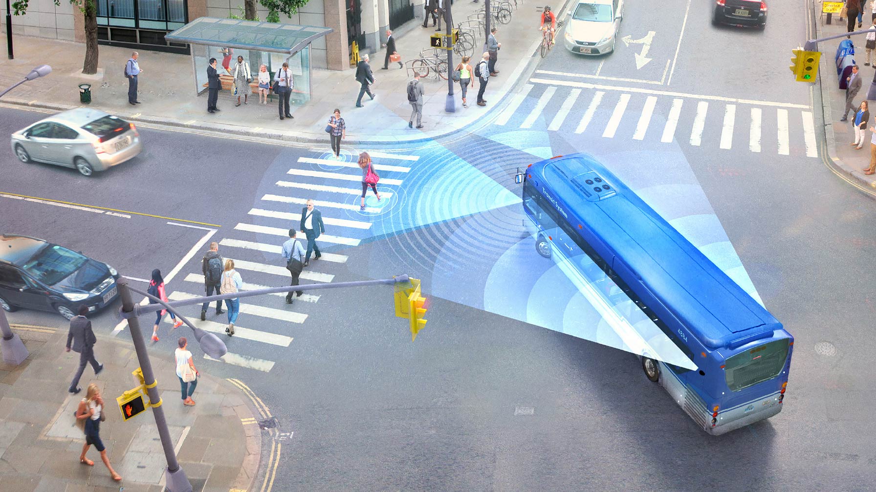
The goals is to provide cities with the ability to visualize and analyze real-time location data from Shield+, improving safety for all road users in urban environments.
Here’s how it works: Mobileye’s Shield+ will stream road safety data retrieved from city fleets into Esri’s ArcGIS platform, where information such as pedestrian and cyclist detection in blindspots can be viewed on the Mobileye Smart Mobility Dashboard. Shield+ alerts will be updated to the dashboard in real time, providing a city-wide view of pedestrian and cyclist safety. This in turn will allow users such as municipal bus drivers to then receive alerts about imminent hazards seconds before a potential collision, and to have a better, safer awareness of the roads they travel.
As a part of this new collaboration, Mobileye will give municipalities entering into new contracts with it the option to incorporate the analytics-based capability powered by Esri’s ArcGIS software.
“Through this collaboration with Esri, we are able to provide a game-changing product to cities and mobility providers,” said Nisso Moyal, director of business development and big data at Mobileye. “By enabling direct uploading of geospatial events from Shield+ fitted to municipal buses and the like to the Mobileye Smart Mobility Dashboard, cities will be able to anticipate and help prevent the next collision, while in general managing all of their assets much more efficiently.”
Category: Featured, General Update, News
Subscribe
If you enjoyed this article, subscribe to receive more just like it.