


Rand McNally Opts for GeoDecisions in Mobile Fleet Management Solutions
 GeoDecisions, a division of Gannett Fleming that specializes in geospatial solutions, was chosen by Rand McNally to provide advanced geographic information system (GIS) services to support its mobile fleet management initiatives.
“GeoDecisions will enable Rand McNally’s customers to visualize, analyze, and leverage data to make more informed decisions on day-to-day routing, fuel economy, and safety,” said Brendan Wesdock, M.C.P., GISP, president of GeoDecisions.
“Our GIS system integration will enhance Rand McNally’s mobile fleet management, assist in compliance with federal mandates such as Hours of Service, and help to improve vehicle maintenance. Positive benefits include more efficient scheduling and fewer driver hours on the road,” he continued.
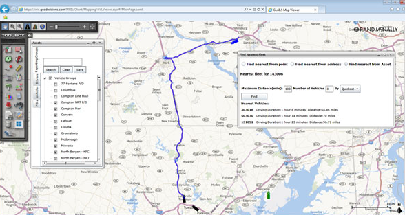
GeoDecisions’ automatic vehicle location (AVL) and asset intelligence services—such as enhanced geofencing and Geo Intelligent Location Server (ILS)—provide Rand McNally with a robust data-sharing information management tool.
These technologies integrate with Rand McNally systems, providing key information such as proximity to other tractors when a shipment leaves or arrives at a facility or up-to-the-minute location notifications and analytics.
Category: Fleet Diagnostics & Software, Fleet Maintenance, General Update, Management
Subscribe
If you enjoyed this article, subscribe to receive more just like it.